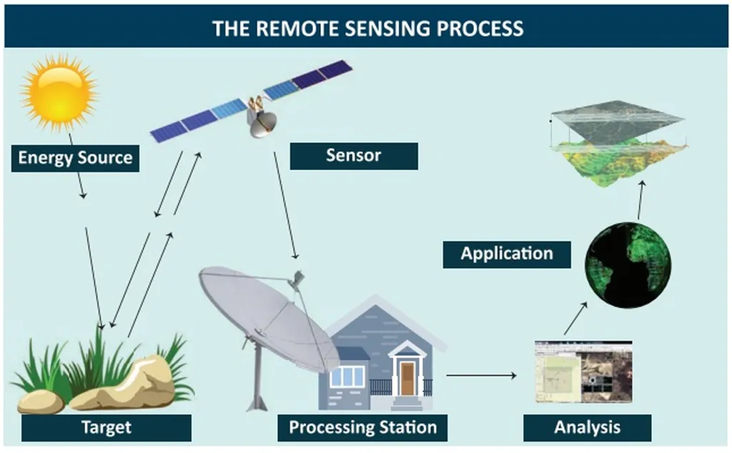
In a world grappling with climate change and urban expansion, the need for precise environmental data has never been more critical. A recent review published in *Geoinformatica Polonica* (Polish Journal of Geoinformatics) sheds light on how Geographic Information Systems (GIS) and Remote Sensing (RS) technologies are revolutionizing environmental monitoring, with significant implications for the energy sector.
Led by Anna Szafarczyk of the AGH University of Science and Technology in Krakow, the research highlights how these technologies are becoming indispensable for tracking environmental changes, from land degradation to biodiversity loss. “The integration of artificial intelligence and machine learning has significantly enhanced our ability to classify and analyze satellite imagery,” Szafarczyk explains. This advancement allows for more accurate and timely data collection, which is crucial for informed decision-making in environmental management and energy infrastructure planning.
One of the key innovations discussed in the review is the use of cloud-based platforms like Google Earth Engine (GEE). These platforms enable scalable analysis of vast amounts of geospatial data, making it easier for energy companies to monitor environmental impacts and optimize resource management. “Cloud-based solutions democratize access to high-resolution data, allowing even smaller enterprises to leverage advanced analytics,” Szafarczyk notes. This accessibility can lead to more sustainable practices and cost-effective solutions in the energy sector.
The review also emphasizes the growing role of Unmanned Aerial Vehicles (UAVs) and hyperspectral sensors. These technologies provide high-resolution monitoring capabilities, which are particularly useful for assessing the environmental footprint of energy projects. For instance, UAVs can be deployed to monitor land use changes around wind farms or solar installations, ensuring compliance with environmental regulations and minimizing ecological disruption.
Moreover, the convergence of geospatial analytics with big data, the Internet of Things (IoT), and citizen science is expanding the scope of environmental monitoring. By integrating data from various sources, energy companies can gain a more holistic understanding of their environmental impacts and develop strategies to mitigate risks. “Participatory approaches, such as citizen science, not only enhance data collection but also foster community engagement and transparency,” Szafarczyk adds.
However, the review also highlights persistent challenges, including data interoperability, technical capacity gaps, and policy integration barriers. Addressing these issues will require greater investment in open-source tools, interdisciplinary collaboration, and inclusive data governance. “The future of GIS and RS lies in real-time monitoring, ethical frameworks, and the democratization of spatial intelligence,” Szafarczyk concludes.
For the energy sector, these advancements present both opportunities and challenges. As companies strive to meet sustainability goals and comply with environmental regulations, the ability to access and analyze high-quality geospatial data will be crucial. By embracing these technologies, energy firms can enhance their environmental stewardship, optimize operations, and contribute to a more sustainable future.
The research published in *Geoinformatica Polonica* (Polish Journal of Geoinformatics) underscores the transformative potential of GIS and RS technologies. As these tools continue to evolve, they will play an increasingly vital role in shaping the energy sector’s approach to environmental monitoring and sustainability.